New version (2025B) available for download...
Need your full-access code for the Centennia Historical Atlas?The Centennia Atlas is a map-based guide to the history of Europe and the Middle East from the beginning of the 11th century (1000AD/CE) through the early 21st century. It is a dynamic, animated historical atlas including over 9,000 border changes. The map controls evolve the map forward or backward in time bringing the static map to life. Our maps display every major war and territorial conflict displaying the status of each region at intervals of a tenth of a year. The maps reflect actual "power on the ground" rather than internationally-sanctioned or "recognized" borders.
The video above is a capture from the Centennia Historical Atlas: Nations Edition. It's a sample of the animation. Since many videos have appeared online using our animations (usually unlicensed!), we have to emphasize that the Centennia Historical Atlas is not a video. It's a desktop app, a software atlas, that can be zoomed in and out, played forward and backward in time, linked to a database of events and explanatory text. Centennia is a guide to history, and it's a convenient way of putting modern events in historical context.
From Kevin Kelly's review of Centennia, published in the Whole Earth Catalog:
"As a kid I dreamed of maps that would move; I got what I wanted in Centennia. This colorful political map of Europe and the Mid-East redraws itself at yearly intervals from the year 1000 to present. It's a living map, an atlas with the dimension of time. I can zoom around history, pause at particular dates, or simply watch how nations melt away, or disintegrate into tiny fragements, or unite! Year by year the outlines of tribes and nations spread, retreat, and reform almost as if they were tides or infections. The resolution of detail... astounding; the breadth of time... thrilling. It rewards hours and hours of study."
Kevin Kelly is editor-at-large and co-founder of WIRED magazine and one of the board members of the Long Now Foundation, devoted to thinking on a millennial timescale.
The Centennia Historical Atlas was required reading for all students at the US Naval Academy at Annapolis for over fifteen years. Over 1100 copies were purchased annually for all prospective naval officers at Annapolis. The app serves as a visual introduction to Western History from a cartographic perspective. Centennia is also licensed by hundreds of secondary schools, colleges, and universities worldwide.
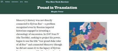
Maps from the Centennia Historical Atlas were recently featured in the respected New York Review of Books in an article by Fordham University History Professor Magda Teter illustrating the medieval and early modern history of Russia and Ukraine.
Current editions of the Centennia Atlas include text in Greek and German, as well as English. To change language while running Centennia, on your keyboard, hit "D" for German (Deutsche), "L" for Greek (ELLenika), or "E" for English.
Individual home users also purchase the Centennia Historical Atlas. It's ideal for anyone who loves maps and history, and it's also popular among genealogy enthusiasts. There's no easier way to get a long-time-scale perspective on the history of the regions of Europe and the Middle East than by watching the borders shift back and forth in Centennia.
Professor Charles Ingrao, Purdue University wrote:
"The Centennia Atlas offers an instant antidote to the problem of changing frontiers. It permits you to view any part of Europe, North Africa or the Levant from A.D. 1000 to [the present]. You can also go forward (or backward) in time, which permits you to see the map change in five-week intervals for the period and region of your choice. Centennia also provides a "historical gazette" and glossary of names/places that students might find useful. It even traces the changing battlefronts between countries in wartime, so you can follow the inexorable march and retreat of the Austrian armies in the Balkans and elsewhere. I was most impressed by the developer's incredible eye for detail, which was more precise (and often more accurate) than Magocsi's new Historical Atlas of East Central Europe. Centennia is no less precise for Germany..."
The Centennia Historical Atlas app runs under Apple MacOS (any version in past seven years), as well as Microsoft Windows (11, 10, etc.). The app has no significant system requirements and will run well on almost any computer manufactured in the past seven years.
The latest version of the atlas, Centennia Historical Atlas: Nations Edition, is available at no charge. It's free. Centennia Nations Edition covers the 150-year period from 1789 to 1939, from the beginning of the French Revolution through the Napoleonic Wars, the revolutions of the mid-19th century, the unifications that led to the creation of the modern nation-states of Germany and Italy, the wars of liberation in the Balkans in the early 20th century, the First World War, the dissolution of the Ottoman Empire, the creation of the modern map of the post-colonial Near East, the Spanish Civil War in the 1930s, the rise of Nazi Germany, and the events leading to the Second World War. All of the data, maps, and text for the complete edition of the Centennia Historical Atlas covering the ten-century period from the year 1000AD to the present are included in the app and can be accessed by entering a full-access code (available for purchase).
Comments:
J.A.H.

